With increasingly more operators and contractors resorting to an aerial perspective of their corridor, our drone solutions provide the accuracy of maps with the immediacy of aerial videography for project management and design engineering to be dynamic.
| URBAN DEVELOPMENT | TRANSPORT | MINING |
TRANSPORTATION
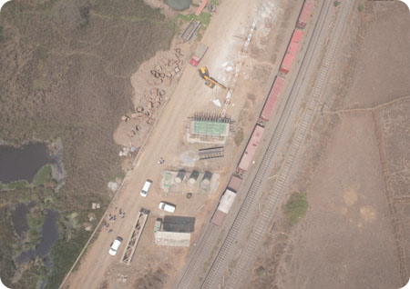
RAILWAYS
Airpix is associated with some marquee Indian Railway Projects for surveying, planning and project monitoring using drone survey and drone videos. We provide mapping, land record digitiziing, base map generation, GIS, geotagged videos, orthophoto generation and drone data management portal for easy viewing, accessing and sharing of drone data of different projects. We have covered more than 500km of Indian railway lines, multiple early stage projects, station yards and existing railway station development projects for Central Railways, DFCC, Rail Vikas Nigam Ltd. for their drone data project requirements.
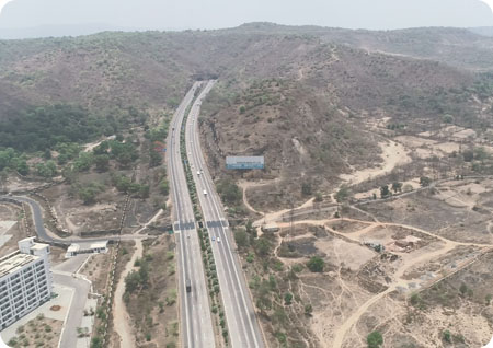
HIGHWAYS & ROADWAYS
Drone survey provides for quick and accurate survey of roads and highway projects. For planning of existing highways, Airpix drone survey provides data required for junction planning, by pass designing and lane extension. For greenfield projects, our quick topographic survey provides auhtorities with orthophoto, DTM, contur and cut fill estimation to carry out engineering design of the new highways. Drone videos help to quickly analyze the entire alignment both for designing purposes and traffic survey. Government boides such as MSRDC, NHAI, IHMCL and state government departments are the users of this technology.
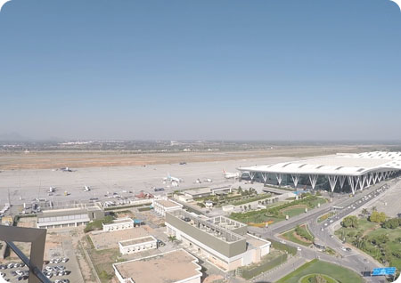
AIRPORTS
Our unmanned aerial vehical provides near real-time video monitoring with high-resolution geospatial inputs, we provide the perfect drone-based solution for useful studies, Detailed Project Reports, project monitoring and level comparison on one platform for project planners, design engineers and project management consultants to collaborate and get things done. Read our case study on how AIRPIX drone survey and drone video solutions are helping the Navi Mumbai International Airport project