Water availability is a crucial parameter for agriculture output. With about 60% of agriculture land in India but only 15% rainwater harvesting, India has the potential to realize much higher agriculture outputs with better canal mapping and natural irrigation. Airpix's drone services in India provide critical insights required for canal mapping, designing, and simulation. Our solutions give detailed information about land use classification, agriculture field distribution, cross-section terrain, and on-ground features so that authorities can design natural canals and lift irrigation systems to ensure water availability to every farm and also avoid damages due to floods during heavy rains.
| AGRICULTURE | CANAL MAPPING |
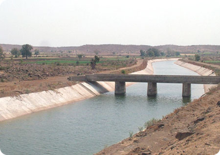
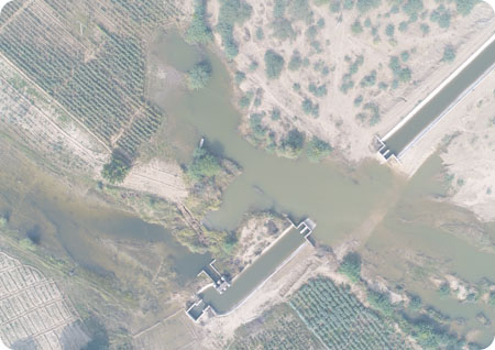
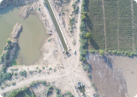
DRONE SURVEY FOR IRRIGATION
Airpix captures aerial photographs by drone surveys to generate high resolution and accurate orthophoto, Digital Elevation Model (DEM), Digital Terrain Model (DTM), and contour maps. The data serves as an input for authorities to simulate models and understand the flow of water so that they can design canals accordingly.
LAND RECORD DIGITIZATION
Using our high-resolution orthophoto as a base map, all on-ground features are digitized, cadastral & revenue map overlaid and detailed reports are generated regarding land use classification so that authorities can have an up to date information about on ground conditions
WEB APPLICATION TO VIEW, SHARE AND COLLABORATE
Authorities can host all the data on our web application so that they can access the data from anywhere and collaborate with different departments and contractors to quicken the design & development of canals
What we offer
ANALYSE
Analysis allows stakeholders to visualize the area of interest remotely and plan with foresight about the elevation and geo-location data of features of interests such as vegetation building and other agriculture applications.
TRACK
Monitor the evolution of canals as they pass through maintenance cycles and ensure that the Right of Way is always present with pro-active vegetation and encroachment management possible with real-time drone maps and videos.
DETECT
Drone solutions realize the possibility of pre-programmed maintenance runs that automate change detection of structural and anomalies such as alignment change, physical damage, leaks below and above ground.