New technology and innovation has lead to usage of drones in agriculture. Airpix provides drone survey based agriculture farm mapping to take you a step closer to precision farming. Our professional drones with multiple high resolution sensors map large areas in a short time giving you insights on crops laid, annomalies and healthy vs non healthy crops in your farms. Our data also helps government bodies to get detailed information of farms and farmers by intergrating cadastral data with our orthophoto. Our presence across India has also enabled on demand deployment to carry out crop damage assessment of agriculture fields during natural calamities thus assistig in transparent and fast agriculture crop insurance claims and settlement.
| AGRICULTURE | CANAL MAPPING |
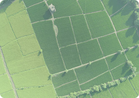
DRONE SURVEY FOR PRECISION AGRICULTURE
Drones in india are widely implemeted in agriculture. Drones in agriculture are used for survey have RGB and NIR sensors that gives multi spectral data of the agriculture farms . This data is processed to generate high resolution base maps in the respective bands and then carry out NDVI analysis to find out relative crop health in the field - an insight that can be used to improve fertilization and optimized water treatment
CROP COUNTING AND YIELD ESTIMATION
Our GIS and image processing team carry out data processing, drone calculations of the drone survey completed to give you autonomous output regarding the tota number of crops in a field and integrate it with the NDVI analysis to give insights on potential yield estimation of your farm. Timely survey of farms with our systems can help you realize higher outputs

CROP INSURANCE
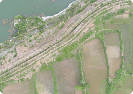
Drone survey data integrated with GIS and land records data gives government bodies transparent data on the crops being grown, land ownership and farmer details. During natural calaimities, Airpix drones deployed collects on-demand information for damage assessment of agricutlure fields thus giving government, farmers, insurance companies and consultants complete transparent information on the extent of damage crop wise and field wise.
What we offer
6,000 Acres Per Day
NDVI Analysis
AI Based Crop Counting