Drones can be used for close-range mapping. In an engineering survey works, the conventional survey involves huge cost, labor, and time. Drones are very practical in providing reliable information for many applications such as road design site monitoring. The drone can provide the output that meets the accuracy of engineering surveys and policies, especially for small-scale mapping. UAVs and drones are also a competitive technology that is stable and rapidly developing, same as other surveying technologies. This study examines the performance of multirotor UAV for road design. This study involves four phases which consist of Planning, data collection, data processing, and analysis. This study focuses on the drone as a tool to capture data of the ground from a certain altitude. The analysis includes drone flight planning, image acquisition, and accuracy assessment of road design. It can be concluded that drones can be used to provide data for road design with reliable accuracy.
This study involves four phases which include preliminary study and planning, data collection, data processing, results, and analysis. The methodology plays an important role in implementing this study accordingly. The first phase is on the preliminary study and the planning of the work which are crucial parts of the study that require a lot of reading and planning. The first phase also includes calibration of the equipment and measurement of data. The next phase is on data collection using drone images and getting the detailed plans. Then, both sets of data are processed for the third phase of this study which is data processing. The UAV images are processed using the software which can generate the X, Y, and Z coordinates of the proposed road. This phase also comprises the construction of road mapping of the area of interest. After the data processing is completed, the results are analyzed
Dedicated Freight Corridor Corporation of India Ltd. (DFCCIL) is established by Indian Railways for construction, operation and maintenance of the dedicated freight corridors linking the four metro cities of Mumbai, Delhi, Howrah, and Chennai. Totaling to about 10,000km, this Golden Quadrilateral is a crucial part of India’s growth and development.
AIRPIX provided drone-based project monitoring and site analysis solution to Western Corridor’s 421km stretch from JNPT to Vadodara with quarterly reporting and status based on chainage, ROB, RUB and other critical locations, thus giving critical insights to higher authorities, Government officials and stakeholders
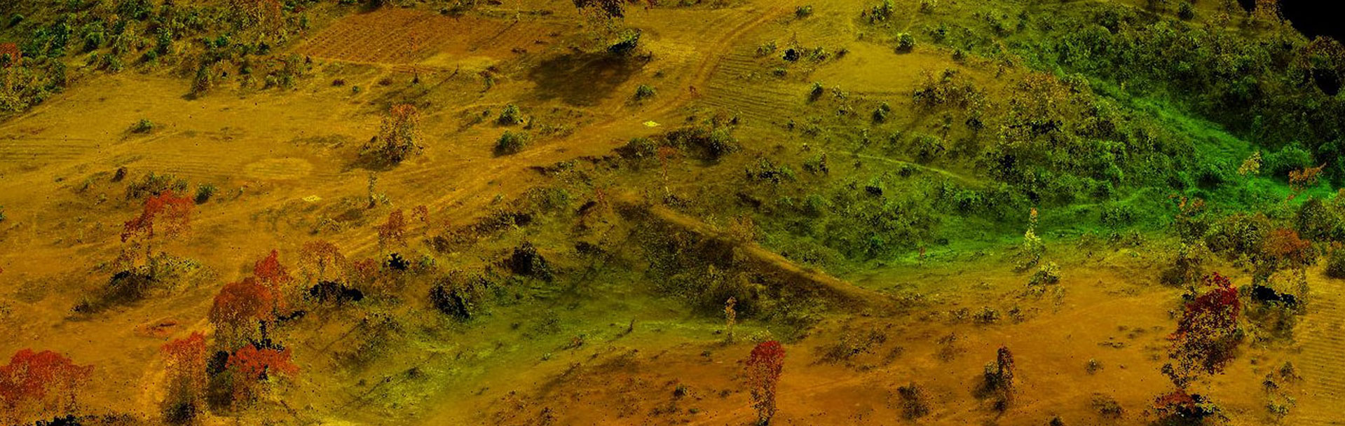
Airpix offers drone technology for accurate surveys. Using drones for large Projects can be monitored in a day. Unlike traditional monitoring techniques, Airpix's solution is fast and offers very high-resolution visual information. Otherwise distant areas can now be monitored in a matter of minutes using Airpix's packaged solution. We offer you a detailed digital surface model(DSM/DEM) with a grid size of under 10cm X 10cm X 10cm and a very high-resolution Orthophoto that enables you to see every detail of the site and also make it possible to measure distances or areas on the site.
Highway surveys are very challenging and time-consuming. Maximum reasons being the site locations are not easily accessible and the problems created by property owners during the survey. The aerial approach seems to be a perfect fit for such situations wherein the movement along the alignment will be minimal and most of the time the work can be completed without entering the private property.
Also as we have formerly mentioned the survey grid can be adjusted according to the needs of Highway Engineers requirement. Implementing the contour details to a very high degree. Also, the result of the cut-fill estimation will be more accurate compared to the traditional approach.