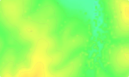
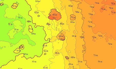
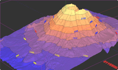
Contour Mapping is an extensive output of UAV data processing, Contour Survey. Contour mapping is developed by connecting all the points of similar elevation together. These lines are drawn on a plan of a particular terrain to understand the nature of the surface, identify cut fill volume, study water flow characteristics, estimate valley depth and steepness. Contour lines form a smooth curve of the same elevation points.
Elevation maps create valuable insights across industries. Some common uses
include
Construction: Most Computer Assisted Design (CAD) programs use vector maps as the file
format of choice, which makes contours the best representation of the real world.
Mining: Similar to Construction use cases, contours are heavily used in mining for volumetric
measurements. Topographic maps are critical in variable-rate fertilization. Contour maps are required when measuring were to draw away excess moisture in
the soil.
Contour mapping is commonly used to understand the terrain profile for multiple uses as follows: Minimizing and balancing earthworks by deciding the routes of the railway, road, canal or sewer lines using contour mapping Catchment area and quantity of water flow at any point of canal or river is found out using contour lines In agricultural work, contours maps are useful as guidelines in the planning of trees on hilly terrain and also land improvement projects. In addition to this, the drainage system is also conveniently planned with contour maps.Initial feasibility study for Ropeway construction, a survey needs to be done to analyze the terrain for desired ropeway, cable car path Volumetric calculations are performed as required for extracting the volume of rocks, gravel of a mountain and assess it’s total value. Hence, Effective Cost estimates are made available with the help of the contour maps Contour lines are also beneficial for Mining companies especially for calculating the volume of stocks Archaeological surveyors are using contour lines to get insights about the history.
Drones are used to collect information in the form of high-quality images. The complete captured
data is aligned by aerial triangulation. The aligned data is then ortho-rectified and
georeferenced using the GCP information. Subsequently, the final Digital Elevation Model &
Contour lines at required elevation change are generated. Want to carry out a contour line
survey at your site?
Contact us at +91 90282 08536 or rather just drop your requirements at
contact@airpix.in