Drones are consistently proving to be powerful commercial tools, simultaneously providing adopters with leaps in efficiency and safety. The surveying and mapping industry is no exception. Airpix with its capability to capture data from above successfully surveyed Banas river and integrated into workflows to perform land surveys, photogrammetry, 3D mapping, topographic surveying, and more.
Whether you’re a qualified surveyor looking to expand your toolkit, or you’re a drone enthusiast who wants to know more ways to use their drone, or you’re just generally interested in this application of drones, we’ve put together an article to help you learn everything you need to know when it comes to getting started with drone surveying.
Since adopting drones into their workflows, many surveyors ask about aerial surveying accuracy. What degree of certainty can drone surveying techniques achieve?
Drone Surveying solutions can outturn surveys with different degrees of accuracy, depending on the requirements of the project.
For a few applications, like checking crop growth, or construction progress, high relative accuracy is sufficient. For other jobs that also require high absolute accuracy, there are drones equipped with real-time kinematic (RTK) and post-processing kinematic (PPK) capabilities. When paired with a few GCPs (Ground control points), survey-level accuracy can be achieved.
Building on your choice of data sensors and surveying software, drone surveying can produce a variety of deliverables with use cases in many industries.
The Banas is a river that lies entirely within the state of Rajasthan in western India. Banas River comes from Aravalli Hills, Rajasthan and meets into rann of kutch. Its length is 266 km. & the total catchment area is 8674 sq.km.It is a tributary of the Chambal River, itself a Yamuna tributary, which in turn merges into the Ganga with a length of about 512 kilometers.
Check out how Airpix offered drones for aerial surveillance and delivery of medicines to disaster areas.
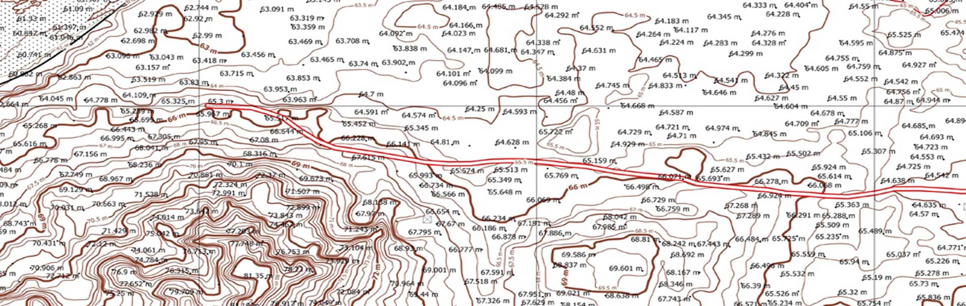
We, at Airpix, surveyed land affected due to floods near Banas River. The purpose of the survey was to get an understanding of water flow and its movement for land use studies. We created an Orthomap to visually asses the area surveyed and spot its spatial features such as water bodies, Highways, and Canals.