Drones are becoming a prevalent tool in any surveyor or site manager’s toolkit. It’s ushering in a new era for topographic surveying by permissive capturing of detailed site maps, including contours and terrain, for a fraction of the time and cost of traditional methods.
The Drone is a versatile platform that is breaking out as a disruptive technology. One of the many civilian applications for a drone is to automate land monitoring and surveying. Field surveying is typically performed by teams of two to four surveyors, and current surveying techniques leave room for improvement. Using a drone to automate the land surveying process will save surveyors’ time and money, as well as reducing potential risks to equipment and personnel. Optimizing the flight path for a drone to survey an area of land can be done using a variety of methods. Using algorithm-based path planning of surveying Drone, given topographical elevation data, a prescribed area of operations as well as additional constraints such as no-fly zones and other air traffic restrictions.
Government regulators are making it effortless to get certified to fly a drone for monetary use. And drones increasing affordability powers a complete survey in less than an hour with Data turnaround in 24 hours.
Drone survey information is already being used in many land development projects. From the initial stages of monitoring and designing land subdivisions, through to preconstruction assessments, it also assists in process tracking and finalizing builts.
Civil contractors are among the recent adopters of drones. They say that drone-captured data, when used with ground control systems provides a quicker, easier, and safer way to produce digital terrain models and aerial site maps than previous methods.
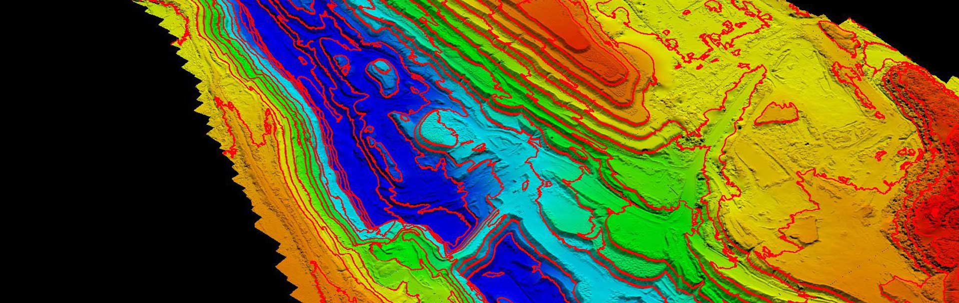
Unlike conventional topographic survey information which is essentially a series of linework drone surveys include a contour map, digital terrain model, dense point cloud, and orthophotos. The result is a highly accurate, visual dataset. All ready for analysis.
With measurable 3D site surveys, virtually anyone on a site can access and use drone topography data on demand. Shared actively and safely across the project team, Airpix datasets can be used to document how a site looks before earthwork starts, and track every step of progress along the way.
With Worksyte an easy-to-use tool offered by Airpux to measure and annotate datasets, stockpile volumes can also be accurately measured in under a minute and haul road grades can be measured in seconds.
Using a surface-to-surface comparison, site terrain can be viewed against design to see where material should be added or removed. Timeline sliders make it easy to visually track changes in specific areas, or across the entire site, to make sure everything’s on track for successful completion.