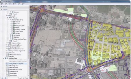
Airpix offers drone survey with 2D & 3D feature extraction to assist you in survey and planning. Being a leading drone service company in India, we provide you Site Monitoring with detailed base map and topography data analysis to manage complex issues associated with large infrastrcuture projects and land record management. Our reports and analysis help to support large infrastructure projects such as Navi Mumbai International Airport, Indian railway projects, railway station development, town planning and mine planning & scheduling
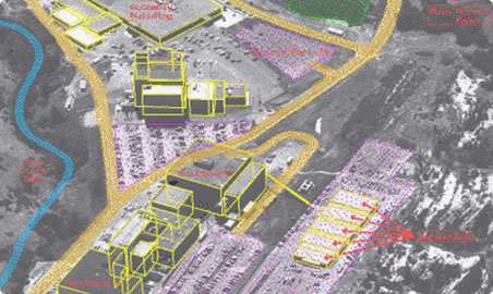
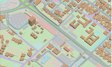
Our team of GIS and photogrammetry experts can assist you in any remote sensing projects or drone data processing. Detailed 2D and 3D feature extraction can be carried out from aerial imagery and dense point cloud for all surface feature extraction, spot elevation marking, contour generation and CAD drawing overlay and matching. You can contact us for any GIS mapping project or GIS application development related to any industry. We are one of the top GIS companies in india.
For large scale projects, Airpix team can map your area of interest periodically for change detection analysis, identify any illegal encroachment and for project progress monitoring. The data can be integrated with your project plan to provide critical project data insights